
Emma-Earl Bridge Connects Guelph's Waverley and Exhibition Park Neighbourhoods
Updated: Sep 11
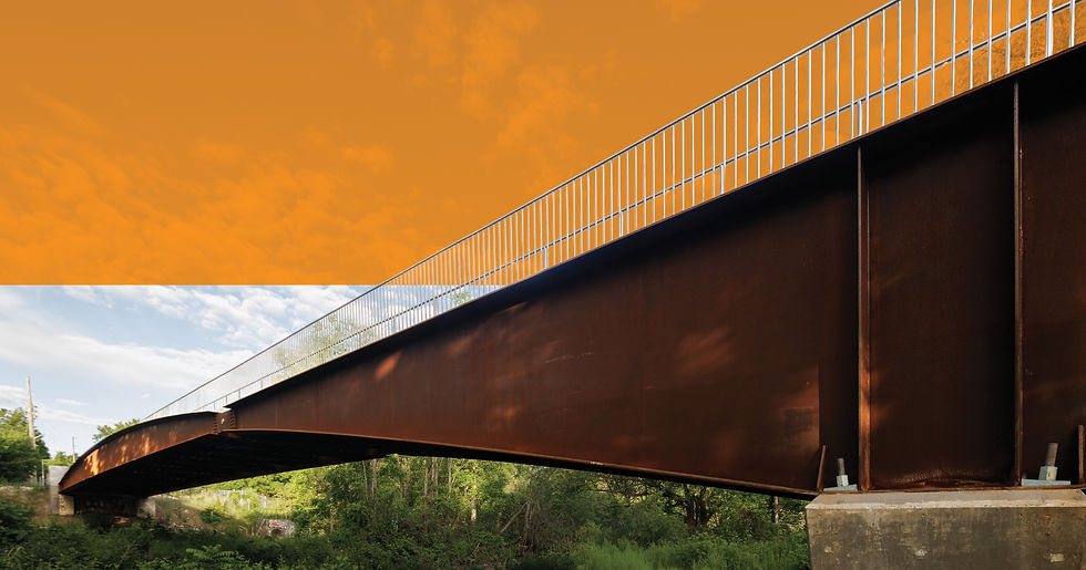
The City of Guelph faced a strict delivery window to complete the Emma St. to Earl St. active transportation bridge in time to support the nearby Speedvale Bridge rehabilitation.
The Speed River flows through Guelph, Ontario, forming one of the defining geographic features of the city. North of downtown Guelph, a 1.5-km stretch of the river lacked any type of pedestrian crossing, creating a barrier between the Waverley and Exhibition Park neighbourhoods on each side of the waterway. For decades, this barrier created demand for a bridge to connect the communities.
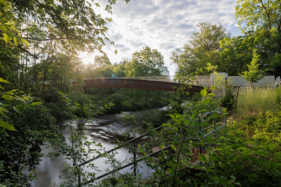
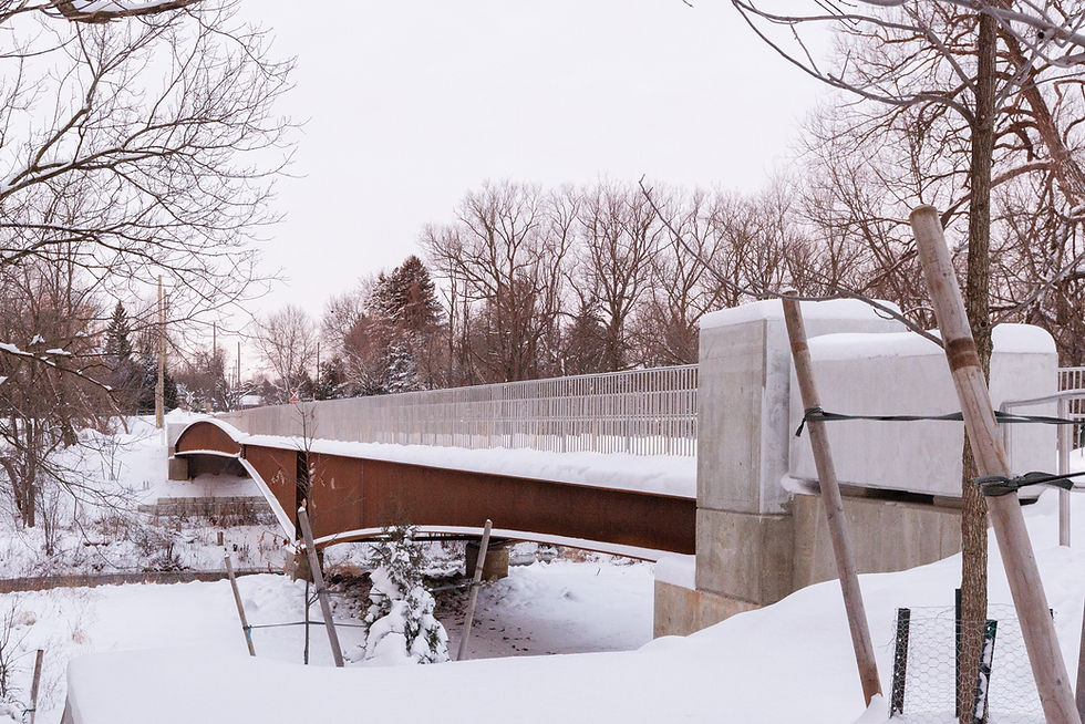
The planned rehabilitation of the nearby Speedvale Bridge to the north created the final impetus for the construction of a bridge across the river, connecting Emma Street to the northeast with Earl Street to the southwest. In 2022, the City of Guelph retained the multi-disciplinary design team of Entuitive, BT Engineering, Montgomery Sisam Architects, and Schollen and Company Landscape Architects for the design of a new active transportation bridge across the Speed River. The finished bridge features two spans, 55 metres and 26 metres in length, and a cross section that consists of two variable depth weathering steel I-girders supporting a precast concrete deck with a 4-metre walkable width.
Community-Oriented Development
In addition to providing a critical detour route during the Speedvale Bridge rehabilitation, the City of Guelph recognized that the Emma-Earl bridge project was an opportunity to create a permanent, safe, inclusive, and memorable addition to the City’s active transportation network. Early on in the project, the design team worked with City staff to identify key priorities, including:
Accessibility – Provide a path that is designed for safe year-round use by pedestrians, cyclists, and mobility devices of all capabilities.
Ecological Preservation – Minimize short-term disruption to local river habitat and contribute to long-term net ecological benefits to Speed River.
Network Integration – Create a seamless connection to the broader Downtown Trail network by linking the Waverley and Exhibition Park neighbourhoods.
Safety – Design with Crime Prevention through Environmental Design (CPTED) principles in mind, providing good lighting and a straight alignment with long, clear sightlines.
Utilities Coordination – Use an existing corridor across the river and shift the overhead hydro crossing into conduits supported below the bridge deck, improving both the natural beauty of the site and the reliability and capacity of the utility crossing.
Before the final design was approved, the community was invited to communicate feedback on the top two design concepts in Fall 2023. More than 500 residents engaged with this rare opportunity to shape their built environment. Community feedback indicated a clear preference for the simplicity of the steel girder design. This aesthetic preference was well aligned with the constructability, cost, and schedule benefits of this solution, making it an easy decision to proceed with the design.
Delivering Guelph’s New Steel Girder Bridge
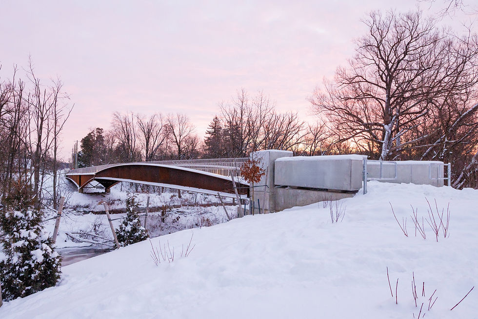
The form of the bridge is based on a simple logic: the girders are shaped to match the shape of the bending moment diagram for permanent loads. This leads to a variable girder depth, greatest at the pier and at the midspan of the 55-metre main span, reducing to a minimum depth at the abutments and at the inflection point in the main span. This graceful form is made possible by a moment-limiting hinge at the inflection point, which is also the bridge’s vertical high point. The hinge simultaneously serves as an architectural feature and a functional connection between the pier and main-span segments of the girders.
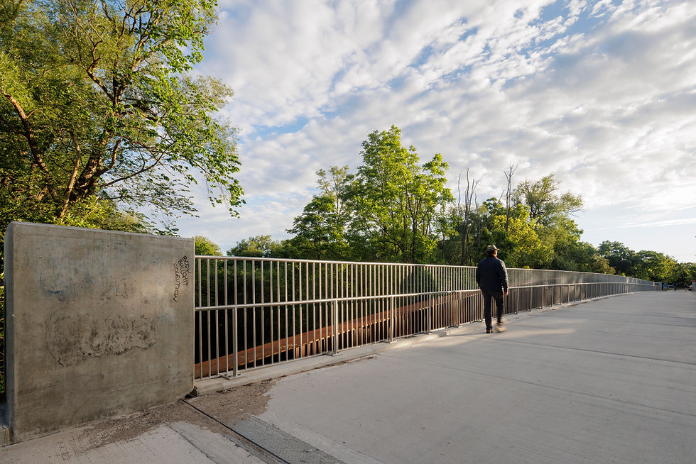
At the east abutment and pier, the supports are designed with full moment connections to the girders. This adds stiffness to the system and eliminates deterioration-prone joints and bearings at these locations. The integral connection is made by post-tensioned anchor rods.
The recently published Pedestrian, Cycling and Multiuse Bridge Design Guideline, CSA S7:23, was used to develop acceleration limits for pedestrian-induced vibrations and to assess pedestrian comfort.
On November 24, 2025, in time for the start of lane closures on the Speedvale Ave bridge, residents traversed the Emma St to Earl St Bridge for the first time, closing a longstanding transportation gap over Speed River.
Sustainable Transportation Infrastructure Supports Active Mobility
“I hope this bridge not only acts as an active transportation link but enables neighbours and neighbourhoods to socialize and connect in this very special place on this Speed River crossing,” said Mike Darmon, Vice Chair of Guelph Coalition for Active Transportation.
Guelph’s commitment to transportation and active mobility continues to grow the city’s network of sustainable infrastructure. The Emma to Earl active transportation bridge connects to the Downtown Trail, provides an alternate route over the Speed River, and minimizes the detour length for pedestrians and cyclists during Speedvale Bridge upgrades.
Our collaboration with BT Engineering, Montgomery Sisam Architects, and Schollen and Company Landscape Architects, and the skilled construction work by Looby Constructors, was key to delivering the bridge on time and implementing community objectives that benefit residents of Guelph.
Contact Entuitive to learn how our bridge engineering expertise contributes to successful transportation infrastructure projects.